PhD fellow Anna Sejbæk Torp-Pedersen has recently published her article, "Charles-Joseph Minard’s Borders: Cartographic Anxiety and Maps of Migration".
The article appeared in the Artium Quaestiones, an academic annual journal edited by the Department of Art History at Adam Mickiewicz University in Poznań.
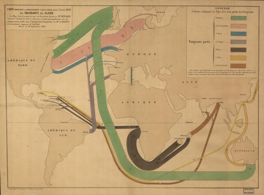
In 1862, the French civil engineer Charles-Joseph Minard published his Figurative and Approximate Map Representing the Emigrants of the Globe in the Year 1858, the Countries from Which They Leave and Those Where They Arrive. The world map showcases broad lines connecting the continents, dividing the categories of people travelling by nationality or city of departure and sorts them by colour, such as blue or green. However, the last three categories, the country of China, the continent of Africa, and the region of South Asia, are depicted in yellow, light brown, and dark brown. It is one of the earliest flow-maps of migration, and it contains no borders.